
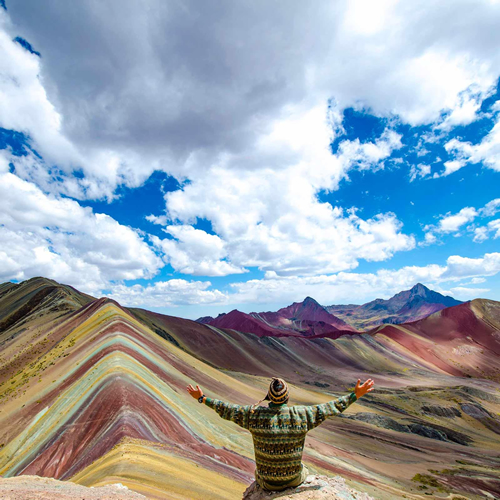

Things to do in Puno in 2025: activities and places to visit on your next trip
Located more than 3,800 meters above sea level on the shores of Lake Titicaca, Puno is one of the main cultural centers of Peru and the Andean world. Known as the “Capital of Peruvian Folklore,” the region boasts a vibrant indigenous Aymara and Quechua tradition, evident in its dances, rituals, and festivities. Notable events include the Festival of the Virgin of Candelaria, which has been recognized by UNESCO.
Table Of Content
- Lake Titicaca is the sacred lake of the Andes
- DIVISION OF THE LAKE
- 1. Lake Titicaca (northeastern sector)
- 2. Minor Lake (Wiñaymarka), in the southwestern sector.
- ORIGIN AND GEOLOGY
- POPULATION AND CULTURE
- History and Mythology
- Important Islands
- Uros
- Taquile
- Amantani
- Flora and Fauna
- Most popular activities
- ENVIRONMENTAL PROBLEMS
- SYMBOLIC AND SPIRITUAL VALUE
- In summary
- Sillustani archaeological complex
- Strategic location
- What are chullpas?
- Engineering and Architecture
- Characteristics of the Chullpas
- Construction techniques
- Historical and Cultural Context
- The Colla culture (1100-1450 CE)
- The Inca period (1450-1532 CE)
- COSMOLOGICAL SIGNIFICANCE
- UMAYO LAGOON
- Current Interpretations and Legends
- How to Visit
- Why visit Sillustani?
- Aramu Muru is the mystical portal of the Andes
- Location
- Main Legend
- Spiritual importance
- Natural Environment
- Here is some useful information for visitors.
- City of Puno, capital of the Peruvian Southern Altiplano
- Location and general characteristics
- Brief History
- Population and Society
- Cultural Identity
- The Feast of the Virgin of Candelaria is celebrated in February.
- Other cultural expressions include
- TOURIST ATTRACTIONS
- Within the city
- Near Puno
- Economy and Production
- Access and Transportation
- Mystical and experiential tourism
- Carlos Dreyer Municipal Museum: cultural treasure of Puno
- Rooms and Collections
- Hours of Operation (2025)
- Entrance fees
- Location
- Recommendations
- Conclusion
- What is the Feast of the Virgen de la Candelaria?
- When is it celebrated?
- Main Activities
- Contest of Dances of Lights
- Masses, albas, and parades.
- Parallel Celebrations
- How can you participate?
- As a spectator
- As a participant
- Venue
- Tips for Your Visit
- Viewpoint of the Condor (Kuntur Wasi)
- Location and Access
- What can you see from the lookout point?
- Ascent and Difficulty
- Hours and Security
- Practical Recommendations
- In summary
The region’s altiplanic geography, characterized by a harsh climate and beautiful landscapes, has fostered a resilient collective identity deeply rooted in the land and an ancestral worldview. Monuments such as the Chullpas of Sillustani, the Floating Islands of the Uros, and the mystical Portal of Aramu Muru reveal a millennial history where the mythical and the archaeological intertwine.
Despite modernity and growing tourism, Puno maintains its original essence, representing a synthesis of past and present, nature and culture, and myth and reality. It is a place where history is not only preserved but also lived.
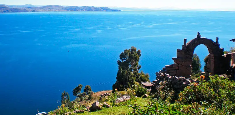
Lake Titicaca is the sacred lake of the Andes
Geographical location:
It is located on the Collao Plateau between southeastern Peru (the Puno Region) and western Bolivia (the La Paz Department). Lake Titicaca is the highest navigable lake in the world and one of the largest in South America.
Altitude: 3,812 meters (12,507 feet) above sea level.
Total area: 8,372 km².
Peru: 56%.
Bolivia: 44%.
Length: approximately 190 km.
Maximum width: 80 km.
Average depth: 107 meters.
Maximum depth: 281 meters.
Volume of water: 893 km³.
The average water temperature is between 10 and 14 °C.
DIVISION OF THE LAKE
The lake is divided into two main sectors.
1. Lake Titicaca (northeastern sector):
It is the deepest and most extensive lake.
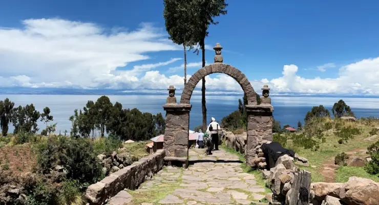
Most of the large islands, such as Taquile, Amantaní, Isla del Sol, and Isla de la Luna, are located here.
2. Minor Lake (Wiñaymarka), in the southwestern sector.
It is shallower.
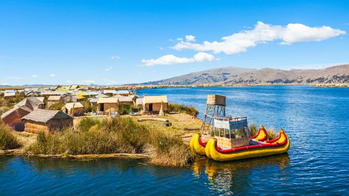
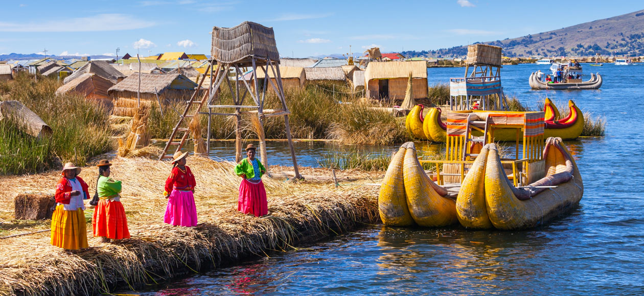
The floating islands of the Uros are found here.
ORIGIN AND GEOLOGY
Lake Titicaca is of tectonic origin, formed approximately 60 million years ago.
More than 25 rivers feed it, and it drains its waters through the Desaguadero River, which flows into Lake Poopó in Bolivia.
Due to its age, marine fossils have been discovered, prompting theories that it may have been connected to prehistoric oceans or lakes in the past.
POPULATION AND CULTURE
More than two million people live near the lake. Many of them belong to the Quechua, Aymara, Uru, and Mestizo peoples.
Outstanding cultures:
The Uros live on floating islands made of totora, an aquatic plant they use as a base, food, and construction material.
The Aymara inhabit the southern part of the lake and have deep agricultural and spiritual traditions.
The Quechua people live on the islands of Taquile and Amantaní and have a strong sense of communal organization and craftsmanship.
History and Mythology
The mythical center of the Andes.
According to Inca mythology, Lake Titicaca is the birthplace of the sun god Inti and the first Inca ruler, Manco Capac.
Manco Capac and Mama Ocllo, the children of the sun god Inti, emerged from its waters to found the Inca Empire.
Pre-Inca Cultures
Before the Inca Empire, millennial cultures developed here, such as the Pucará culture, which had an archaeological center in Peru.
Pucará, with an archaeological center in Peru.
Tiahuanaco (Tiwanaku) is considered one of the oldest civilizations in South America; its archaeological center is in Bolivia.
Colla and Lupaca: Aymara peoples who resisted the Inca expansion.
Important Islands:
Uros:
These artificial islands are made of totora reeds.
The inhabitants live off tourism, fishing, and hunting.
They preserve their own language and culture, though they are increasingly influenced by Quechua and Spanish.
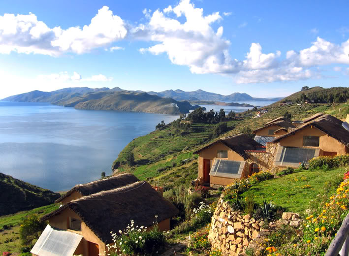
Taquile:
It is a UNESCO Intangible Cultural Heritage thanks to its textile art.
Men begin weaving at a young age, and the hats they wear indicate their marital status.
Amantani:
Experiential tourism in family homes.
The town has two sacred hills: Pachatata and Pachamama, where agricultural rituals are celebrated.
Suasi:
A private island with an ecological lodge.
It is an ideal place to rest, hike, meditate, and stargaze.
Sun Island and Moon Island (Bolivia):
Inca archaeological sites.
Isla del Sol has more than 80 sites, and according to the Incas, it was the birthplace of the sun.

Flora and Fauna
Flora:
Totora (an aquatic plant that is key to the Uros’ way of life).
Ichu: High Andean grass.
Crops: potato, quinoa, barley, and oca.
Fauna:
Giant Titicaca frog (Telmatobius culeus): Endemic and endangered.
Native fish: carachi and Suchi.
Birds: Titicaca grebe, Andean gull, Chilean flamingo, and black ibis.
Mammals: viscacha and Andean fox in nearby areas.
Lake Titicaca Tourism
Most popular activities:
Boat trips to the islands from the port of Puno.
Experiential tourism, such as sleeping in local families’ houses.
Ecological and cultural hikes.
Astronomical observation and Andean rituals.
Landscape, fauna, and cultural photography.
ENVIRONMENTAL PROBLEMS:
Sewage and garbage contamination, especially in the bay of Puno.
Uncontrolled tourism in sensitive areas.
Water levels have decreased in recent years due to climate change and drought.
Peru and Bolivia are developing binational projects to preserve the lake’s ecosystem.
SYMBOLIC AND SPIRITUAL VALUE
Lake Titicaca is more than just a natural resource; it is also a cosmogonic axis and the “navel of the world” for Andean peoples.
The lake continues to be the setting for ceremonies honoring Pachamama (Mother Earth), solar rituals, and traditional festivities that strengthen the community’s connection to nature and the divine.
In summary:
Lake Titicaca is much more than just a natural wonder. It is a place of origin, a sacred space in the Andes, a refuge for living cultures, and a biodiversity reserve. Visiting it means entering a world where history, mythology, ecology, and spirituality are uniquely intertwined.
Sillustani archaeological complex
Strategic location
Exact location: Sillustani Peninsula, Atuncolla District, Puno Province, Peru.
Altitude: approximately 3,900 meters above sea level (higher than the city of Puno).
How to get there: It is 34 km (about a 40-minute drive) from the city of Puno on a paved road to the entrance of the complex.
The site is surrounded by the mystical and serene Umayo Lagoon, which lends a sacred atmosphere to the landscape.
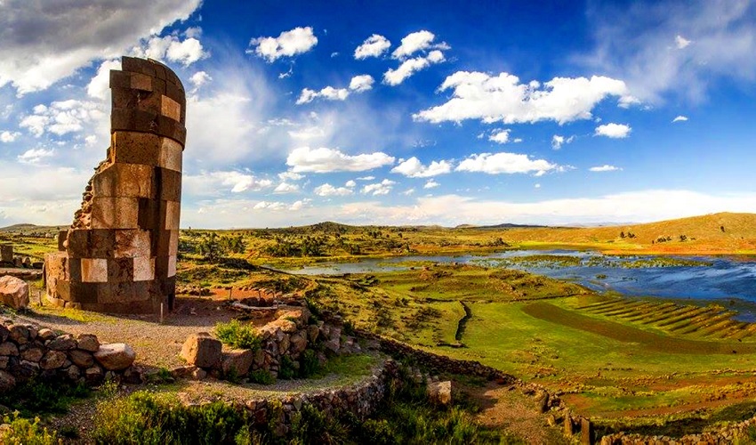
What are chullpas?
Chullpas are cylindrical or square funerary towers built by the Collas, an Aymara people, before the Incas. The Incas later adopted and perfected them.
Function:
They served as collective mausoleums for chiefs, nobles, priests, and other elites.
Mummies were placed inside them in a fetal position and wrapped in fine textiles. They were also accompanied by ceramics, jewelry, food, and utensils. This practice is linked to the belief in resurrection and spiritual continuity.
Engineering and Architecture
Characteristics of the Chullpas:
Height: Between 2 and 12 meters.
Shape: cylindrical, truncated cone, or rectangular. – Cylindrical, truncated cone, or rectangular.
Material: volcanic stone or andesite, cut with precision.
Construction: In some cases, they are joined with mud mortar, and in others, they are joined without mortar in the style of Inca engineering.
The access door is always located towards the east in honor of the rising sun, a symbol of life and rebirth.
Construction techniques:
Hand-carved blocks weighing up to one ton are used.
Some blocks have reliefs and zoomorphic or geometric sculptures.
Internal chambers were built to hold mummified bodies and funerary offerings.
Historical and Cultural Context
The Colla culture (1100-1450 CE):
The Aymara ethnic group that dominated the Collao plateau.
They developed solid architecture, astronomical knowledge, and a rich Andean worldview.
Their language and traditions survive today in some altiplano communities.
The Inca period (1450-1532 CE):
The Incas incorporated the Collas into their empire and adopted some of their funeral practices.
They perfected the design of the chullpas using their cyclopean construction style.
COSMOLOGICAL SIGNIFICANCE
The chullpas’ eastward orientation reflects a deep relationship with the Andean cosmovision, in which the sun, life after death, and duality (life/death, day/night, earth/heaven) are interconnected.
The natural landscape also plays a sacred role. The lake, wind, and altitude create a spiritual atmosphere used in rituals to this day.
The site is believed to have had not only a funerary use, but also a ceremonial and astronomical one.
UMAYO LAGOON
The Umayo Lagoon surrounds the complex, adding scenic beauty and mysticism to the site.
In the center is Umayo Island, which, according to some accounts, was used for ceremonies.
The island is home to high Andean bird species, such as:
Andean flamingos.
Titicaca grebes
Black ibises.
Puna ducks can also be found there.

Current Interpretations and Legends
Today, Sillustani is considered a reflection of the cultural evolution of the Altiplano, from the original cultures to the Inca Empire.
Mysteries: There is still debate over how they managed to move and assemble the enormous blocks with rudimentary tools.
Local myths: Some esoteric stories claim that the chullpas are connected by underground tunnels or possess telluric energies.
How to Visit
Recommendations:
Half-day tour departing from Puno in the morning or afternoon.
It can be combined with visits to Chucuito, Lagunillas, or other nearby rural communities.
Bring:
A coat and hat (because of the cold and wind).
Sunscreen.
Water for the altitude.
Comfortable walking shoes.
Entrance fee:
It is included in the Puno Tourist Ticket, but you can also pay at the entrance.
Local guides are available in Spanish and English.
Why visit Sillustani?
It is also an excellent addition to a visit to Lake Titicaca.
Aramu Muru is the mystical portal of the Andes
Location:
Region: Puno, Peru.
Province: Chucuito.
Distance from Puno: 70 kilometers (about 1 hour and 30 minutes by car).
Altitude: 3,900 meters (12,800 feet) above sea level.
How to get there: It is near the town of Juli and a short walk from the road.
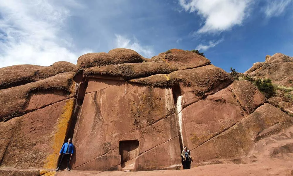
Main Legend:
Aramu Muru was said to be an Inca priest who escaped with the Sacred Solar Disc.
Upon reaching the mystical door, he opened an interdimensional portal through it and disappeared.
Many believe that the door is a “stargate” or entrance to another dimension.
Spiritual importance:
Currently, it is a destination for spiritual tourism where they hold:
Meditations
Andean ceremonies.
Energetic retreats.
Visitors claim to feel intense energy, inner peace, and unusual phenomena when touching the portal.
Natural Environment:
It is surrounded by peculiar rock formations, silent valleys, and clear skies.
Ideal for:
Hiking
Photographing Andean landscapes.
Spiritual connection with nature
Here is some useful information for visitors.
The travel time from Puno is approximately one and a half hours.
Time on site: One to two hours.
Entrance fee: Free, although some communities may ask for a voluntary contribution.
The best times to visit are morning and sunset.
Recommendations:
Bring water, sunscreen, and warm clothing.
Respect the site as a sacred place.
Avoid making unnecessary noise and leaving trash behind.
| Aspect | Details |
|---|---|
| Type of site | Mystical rock formation / spiritual portal |
| Meaning | Considered an “interdimensional portal” by legend |
| Current uses | Mystical tourism, Andean rituals, meditation |
| Accessibility | Easy access from Puno by paved road + short walk |
| Relevance | Cultural, spiritual, and touristic significance |
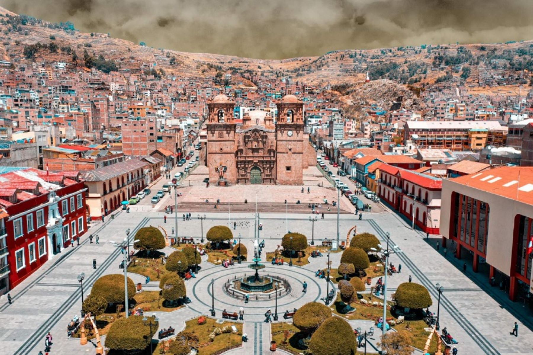
City of Puno, capital of the Peruvian Southern Altiplano
Location and general characteristics
Country: Peru.
Region: Puno (it is its political and cultural capital).
Altitude: 3827 meters above sea level.
Surface area: approximately 70 km².
Geographical location: Southern Andean highlands, in the basin of Lake Titicaca.
Spanish foundation: November 4, 1668, as San Carlos de Puno.
Puno is located on the shores of Lake Titicaca, the highest navigable lake in the world, which is shared with Bolivia. Its altitude gives it a cold and dry climate, with clear skies most of the year.
Brief History:
Before the arrival of the Spaniards, the area was occupied by pre-Inca cultures, including the Pukara, Tiahuanaco, and Collas peoples.
It later became part of the Inca Empire, acquiring religious and astronomical importance.
Following the conquest, the area became an important silver-mining center during the viceroyalty period.
The current city developed around commercial and livestock activities, as well as cultural and nature tourism in recent decades.
Population and Society
Estimated population: approximately 150,000.
The population is mostly mestizo and Aymara, with a Quechua presence.
It has a lively culture with a strong indigenous and rural heritage.
Languages spoken:
Spanish (official and urban language).
Aymara and Quechua are used in rural communities.
Cultural Identity
Puno is known as the “Folkloric Capital of Peru” because of its rich tradition of dances, music, traditional costumes, and celebrations.
The Feast of the Virgin of Candelaria is celebrated in February.
This is the most important religious and cultural celebration.
More than 40,000 dancers and musicians participate in comparsas.
In 2014, UNESCO declared it an Intangible Cultural Heritage of Humanity.
The celebration lasts more than two weeks and includes masses, processions, and contests featuring native and mestizo dances.
Other cultural expressions include:
More than 300 traditional dances are performed, including:
Diablada, morenada, llamerada, sikuris, caporales, and tuntuna.
Typical instruments include the charango, zampoña, quena, and bombo.
There is also colorful, hand-embroidered clothing for ceremonial and tourist use.
TOURIST ATTRACTIONS:
Within the city:
Puno Cathedral: Built in 1757, it is in the mestizo baroque style.
Main Square: The urban and social heart of the city.
Carlos Dreyer Museum: Contains pre-Columbian, viceroyalty, and Inca art.
Mirador del Cóndor: panoramic view of the lake and city.
Port of Puno: departure point for Lake Titicaca.

Near Puno:
Uros Floating Islands (30 minutes by boat).
Taquile and Amantaní Islands offer a cultural and tourism experience.
Sillustani is an archaeological burial complex.
Aramu Muru is a mystical and energetic portal.
Chucuito and Juli offer colonial architecture and temples.
Pomata is known as the “Philosophical Balcony of the Altiplano.”
Economy and Production
Main activities:
Tourism (national and international).
Commerce and services.
High Andean livestock, such as alpacas, llamas, and sheep.
High-altitude agriculture: potatoes, quinoa, barley, and oca.
-Artisanal fishing (carachi and trout).
Local handicrafts:
Textiles made of alpaca and sheep wool.
Decorative ceramics.
Andean musical instruments.
Embroidery on traditional clothing.
Textiles made of alpaca and sheep wool.
Decorative ceramics.
Andean musical instruments.
Embroidery on traditional clothing.
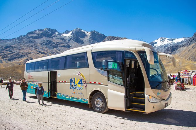
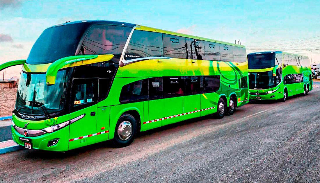
Access and Transportation
The nearest airport is in Juliaca, which is 45 kilometers away. There are daily flights from Lima

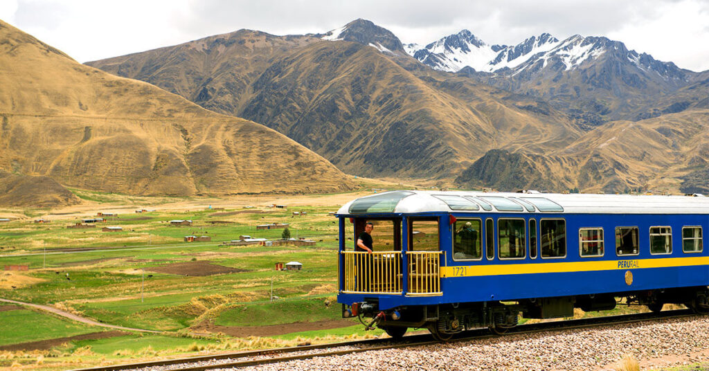
From Cusco, it is a seven-hour drive or a seven-hour ride on the Andean Explorer tourist train.
From Arequipa, it is approximately a six-hour trip.
![]()
Local transportation options include:
Mototaxis, colectivos, minibuses, cabs, and private tourist services.
Mystical and experiential tourism
Thanks to its geography, altitude, and Andean symbolism, Puno also attracts those seeking spiritual or energetic experiences. Places like Aramu Muru and the Titicaca Islands offer traditional ceremonies, a connection with nature, and ancestral practices.
Carlos Dreyer Municipal Museum: cultural treasure of Puno
The Carlos Dreyer Municipal Museum is one of the most important cultural spaces in the Peruvian Altiplano region. Located in the heart of Puno, just steps from the Plaza de Armas and the cathedral, the museum boasts a valuable collection of archaeological, historical, colonial, and republican artifacts, many of which were amassed by the German painter and collector Carlos Dreyer Spohr.
History of the Museum
The museum was founded in 1977 when Carlos Dreyer donated his personal collection to the Municipality of Puno.
The building that houses the museum was declared a cultural heritage site in 1980.
The collection includes pieces Dreyer gathered during his 50-plus years living in Puno, many of which are of great archaeological value.

Rooms and Collections:
The museum has six main rooms and three galleries organized by theme and chronology.
The Inca and Pre-Inca Hall.
Contains ceramics, textiles, weapons, mummies, and tools from the Nazca, Chimú, Pukara, Tiwanaku, and Inca cultures.
The Paleontological Hall and Lithic Gallery.
It features fossil pieces and stone monoliths of the Pukara culture, which is considered a mother culture of the Altiplano.
Sillustani Hall (Death in the Altiplano):
This hall highlights the “Treasure of Sillustani,” which contains more than 500 pieces of gold and silver.
There is also a replica of the Chullpa del Lagarto, the monumental circular tombs of the Collas.
Art Gallery:
It features works by Carlos Dreyer and other regional painters of the Laykakota Circle, a Peruvian indigenous art movement.
Colonial Room:
Silver jewelry, documents of the founding of Puno, and numismatic pieces from the Viceroyalty.
The Republican Room (Dreyer Room).
Republican weapons and ornaments, including the sword of former President Ramón Castilla.
Extras:
Galleries of models of Altiplano archaeological sites.
An urban map of Puno from 1875. This unique cartographic piece is in the process of restoration.
Hours of Operation (2025):
The Carlos Dreyer Municipal Museum is open Monday through Friday from 9:00 a.m. to 6:00 p.m. On Saturdays, the museum is open from 9:00 a.m. to 4:00 p.m.
Some sources indicate that the museum may be open until 7:30 p.m. on special dates, including Sunday afternoons (2:30 to 7:30 p.m.).
Entrance fees:
National adults: 10 soles.
Foreign students: 10 soles.
Foreign tourists: 15 soles.
The museum also offers free guided tours, which can be requested at the entrance or scheduled in advance.
Location:
Address: Jr. Conde de Lemos 289 (at the corner of Jr. Deustua), next to the Cathedral of Puno.
Reference: One block from the Plaza de Armas.
Recommendations:
Include it in a cultural morning or afternoon in downtown Puno.
Bring a light coat, as it may be cool inside the museum due to the altiplanic climate.
Find out about cultural activities and temporary exhibitions, especially during holidays.
Take advantage of the virtual tour on the Municipality of Puno’s website.
Conclusion:
The Carlos Dreyer Museum is essential for anyone wishing to understand the cultural richness of the Andean highlands. With its variety of rooms, proximity to other places of interest in the historic center, and extensive collections, it is an essential stop in Puno.
What is the Feast of the Virgen de la Candelaria?
It is a religious, cultural, and folkloric celebration in honor of the Virgin of Candelaria, the patron saint of Puno. Celebrated mainly in Puno, it lasts more than 15 days and takes place mainly between the end of January and the first two weeks of February.
When is it celebrated?
Main date: February 2 (Day of the Virgin of Candelaria).
The festivities start on the last weekend of January and culminate during the second week of February.
The most important days are:
February 2: Central Mass, procession, and offerings to the Virgin.
The following Sunday, there is a contest of indigenous dances in the Enrique Torres Belón stadium.
The following weekend: A great parade and veneration with dances of lights.

Main Activities:
Procession of the Virgin.
The image has been venerated since the 16th century.
The Virgin leaves in procession through the streets of Puno, accompanied by thousands of parishioners carrying candles and offering prayers.
Contest of Autochthonous Dances:
More than 100 groups participate, presenting traditional dances of the highlands such as the sikuri, karwani, tinya, and qashwa.
The dances express the Andean worldview, especially gratitude to Pachamama.
Contest of Dances of Lights:
Over 60 urban groups participate, showcasing colorful costumes and spectacular choreography.
Standout dances include the diablada, morenada, caporales, llamerada, tinku, and saya for their scenic strength and visual richness.
Masses, albas, and parades.
Throughout the festival, there are daily masses and musical albas starting at 5:00 a.m., as well as smaller processions through the neighborhoods.
Parallel Celebrations:
These include typical food fairs, music band contests, Andean music gatherings, street parties, and free cultural events.
How can you participate?
As a spectator:
Arrive early to the Enrique Torres Belón Stadium to attend the contests (purchase a ticket in advance).
Stand in the grandstands to watch the big parades and processions. Access to some avenues is free.
Dress warmly, as it is still the rainy season in Puno in February and the nights are cold.
As a participant:
Both foreigners and Peruvians can join dance groups if they register several months in advance.
Some associations allow participation with payment and prior preparation, even outside the country, in Peruvian communities abroad.
Venue:
Throughout the city of Puno, especially in Plaza de Armas.
Plaza de Armas
Church of San Juan Bautista (where the image rests)
Central avenues, such as Simón Bolívar and La Torre.
Enrique Torres Belón Stadium (for official competitions)
Tips for Your Visit:
Book your accommodations in advance, as the city fills up starting in January.
Bring a camera with a good battery and protection against rain.
Engage with the locals: many families open their doors to share meals, dances, and clothing.
Respect the religious significance of the festival, which is primarily a display of devotion.
Viewpoint of the Condor (Kuntur Wasi)
The Mirador del Cóndor, known in Quechua as Kuntur Wasi (“House of the Condor”), is one of the best places to enjoy panoramic views of the city of Puno and majestic Lake Titicaca. This viewpoint is ideal for nature and photography enthusiasts, as well as those seeking to connect with Andean spirituality.
Location and Access:
The viewpoint is located on a hill 3,990 meters above sea level, approximately two kilometers from the center of Puno.
It can be reached by:
By cab: The trip from the Plaza de Armas takes between five and ten minutes.
On foot, it takes about 20 minutes from the center, plus climbing 620 to 655 steps to reach the top.

What can you see from the lookout point?
You can see a 360° panoramic view of Lake Titicaca, the city of Puno, and the surrounding area.
You can also see an impressive 11-meter-high metal sculpture of an Andean condor, a symbol of freedom and wisdom in Andean cosmology.
The lookout point is the perfect place to watch the sun rise and set, when the colors of the sky and lake create spectacular landscapes.
Ascent and Difficulty:
The climb is challenging, especially due to the altitude, but it is not technically difficult. It consists of a long staircase that crosses the hill’s slope.
It is recommended that you climb calmly and stop to rest and enjoy the views.
Avoid the climb if you are not acclimatized to the altitude.
Hours and Security
Access is free, and there are no established entrance hours.
For greater security, it is recommended to visit between 8:00 a.m. and 5:30 p.m.
It is not recommended to go up at night since the area lacks lighting and security. There have been reports of robberies and people loitering in the area.
Practical Recommendations:
Take the following with you:
– Water and food.
– Sunscreen and a hat or cap.
– Warm clothes, especially a windbreaker.
Comfortable shoes or hiking boots.
Do not make the ascent alone, especially if you are unfamiliar with the area.
If you are going with children or elderly people, consider taking a cab to the closest possible point.
In summary
El Mirador del Cóndor (Kuntur Wasi) is one of the most spectacular places in Puno from which to enjoy the scenery of the Altiplano and Lake Titicaca. It offers a combination of nature, exercise, and a connection with Andean culture. It is an ideal daytime destination, especially if you are looking for a unique experience with spectacular views.
“Visiting Uros and Taquile is a journey into the living essence of Lake Titicaca, with its traditions, hospitality, and natural beauty. It is the highest navigable lake in the world.”


No Comment! Be the first one.