
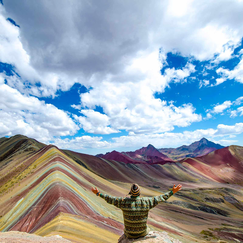

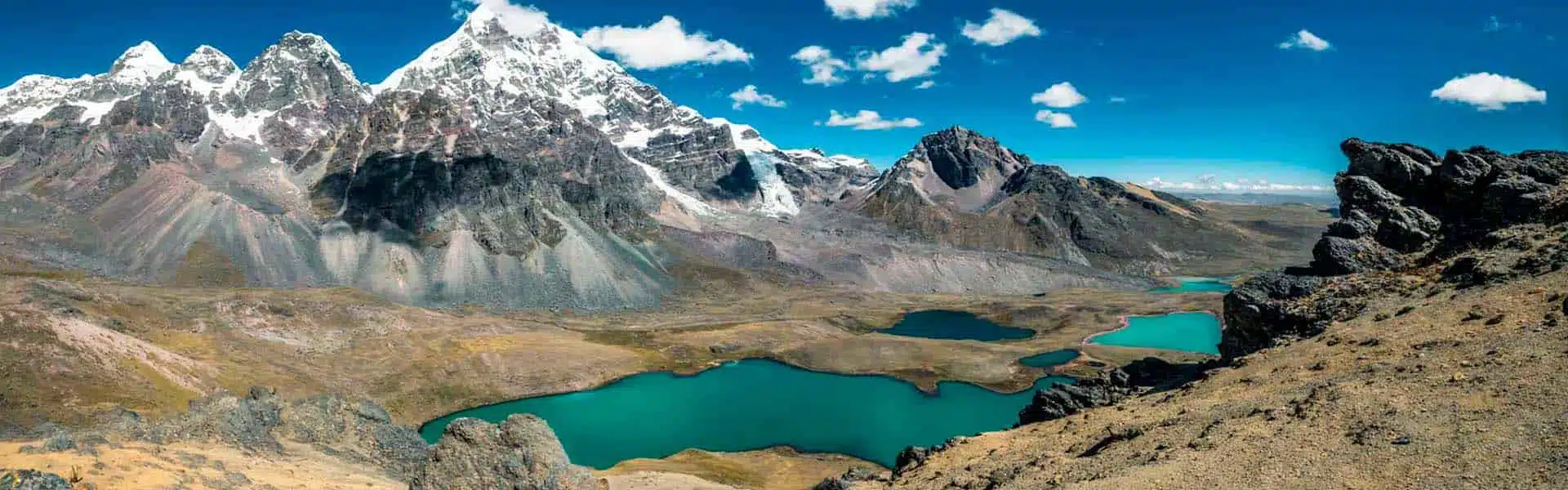
The snow-capped Ausangate and its beautiful circuit of 7 lakes.
Ausangate is the second highest snow-capped peak in Cusco, 6385 meters above sea level. It is located in the Cordillera del Vilcanota, whose mountains are extraordinary and are accompanied by icy lagoons of crystalline water.
Table Of Content
- Possibility to visit the seven lagoons of Ausangate, in Cusco.
- Via Pacchanta, in one day.
- The route to Upis is done in two days
- Details
- Via Ausangate Trek: 6 days, including the Mountain of the Colors.
- Pacchanta Hot Springs
- Location of Pacchanta Hot Springs
- What are the names of the lagoons and at what altitude are they located?
The snowy mountain feeds the lagoons that surround the sacred mountain of the Incas, which in ancient times was considered a divine being that governed the life and death of Andean men and women, who to this day worship the Apus or protective mountains of the Andean world.
Ausangate is the most powerful apu or mountain in the Inca cosmovision and is also known as “The Creator of the Waters”. It is the source of the Vilcanota or Willcamayu River, which feeds and fertilizes the Sacred Valley of the Incas until it enters and gets lost in the Peruvian Amazon jungle.
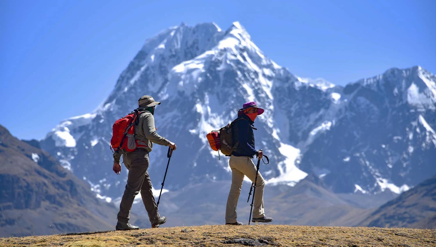
Possibility to visit the seven lagoons of Ausangate, in Cusco.
Via Pacchanta, in one day.
It is the shortest route and the goal is to reach the village of Pacchanta, at 4300 meters above sea level. This is where the trek begins. The first lagoons appear as you walk along a gravel and pebbled puna road, which is flat at first. Climbing to the top, the panorama is the best one can imagine: the snowcapped peaks so close, the lagoons below, and looking back, the mountains disappearing into the horizon.
Details
Hike time: 5-5:30 hours. Maximum altitude: 4630 m. Starting altitude: 4300 m. Distance: 10 km.
Difficulty: demanding.
Admission fee: 10 Soles.
Horse rental: 80 Soles return.
Hot springs: 5 Soles.
Height difference: 330 m.
The route to Upis is done in two days
The goal of this trek is to reach Upis, which is only a few kilometers away from Tinki. The trek starts at 4200 meters above sea level on a relatively flat trail. The distance to be covered during the first day is about 7 km, with a difference in altitude of about 200 meters, until we reach the Upis camp at 4400 meters above sea level. Afterwards we will have lunch and rest the whole afternoon.
During the winter it is more likely to enjoy such unique sunsets, with the last rays of the sun hitting the summit of Ausangate. After the afternoon, night will fall and if the weather is good, we will be able to observe the starry sky.
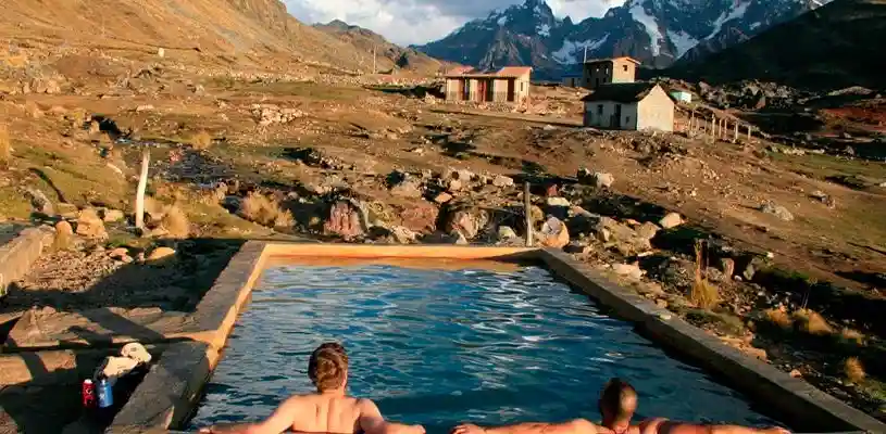
On the descent to Pacchanta, after having seen animals, plants, landscapes and so on. By then you may be a little tired, but something else awaits you in Pacchanta: medicinal hot springs, ready to be a place of rest and relaxation for anyone who needs it after a long hike. It is another option. Afterwards we will return to Cusco.
Details:
Hiking time: 3 hours (first day) and 6 hours (second day).
Maximum elevation: 4630 m. Starting altitude: 4200 m.
Difficulty: easy (first day) and challenging (second day).
Hot springs: 5 $.
Camp altitude: 4430 m.
Via Ausangate Trek: 6 days, including the Mountain of the Colors.
In this option you will be able to see the entire Ausangate route, the most complete, including the Mountain of the Seven Colors. To begin with, in this route you will make the entire return of the great Apu Ausangate. Undoubtedly, the effort of the trek will exhaust your energies, as you will have to cross several passes and face the challenge of altitude and weather. It is a great challenge, but remember, my friend, that all the walking, effort and fatigue will eventually give way to memories.
Without a doubt, this would be one of those trips that will always be remembered. For example, when a man slid down the side of the Otorongo Lagoon and said, “Wait a minute, I feel something different; I feel living energy flowing in this place.
Pacchanta Hot Springs
When visiting the seven Ausangate lagoons, you can choose one of three alternatives, one of which includes visiting the hot springs of Pacchanta. This is typically done after exploring the lagoons, wildlife, flora, and other landscapes. After a long hike, it is just what the body needs. Even if you are tired, take a bath in the medicinal hot springs. The hot springs are a place of rest and relaxation, perfect for anyone who needs it. It’s also a good option before returning to Cusco.
Location of Pacchanta Hot Springs
The Pacchanta Hot Springs are located in the community of Pacchanta, district of Ocongate, province of Quispicanchi, in the region of Cusco. This destination is located about 200 km from the city of Cusco, at the foot of Nevado Ausangate, within the impressive Vilcanota mountain range, at an average altitude of 4300 meters above sea level.
What are the names of the lagoons and at what altitude are they located?
Pucacocha Lagoon, also known as Chocolate Lagoon, is the first lagoon on the circuit. It is located at an elevation of 4,500 meters. Its name translates to “red lagoon,” referring to its red waters. Patacocha Lagoon is located at an elevation of 4,860 meters and offers better views of the snow-capped Ausangate peak. Alcacocha, the third lake, is slightly lower but cold due to the high altitude. Q’omercocha Lagoon, also known as the “Green Lagoon,” is famous for its deep turquoise color and offers the best view of Ausangate. Otorongo Lagoon, shaped like an otorongo, is located at an altitude of 4,620 meters. China Otorongo Lagoon, also known as Female Otorongo, is at the same altitude as a nearby lagoon. Azulcocha Lagoon contrasts with the snow-capped Ausangate mountain.


No Comment! Be the first one.